There are many possible answers to this question (shear, dry air, land interaction, internal disorganization, etc.) but since I’m writing this post as Hurricane Ida is intensifying in the Gulf of Mexico under ideal conditions, I wanted to explain why intensification can happen rapidly, but not instantly. In the process, we’ll learn what to look for at various stages of intensification and why recon data alone doesn’t tell the whole story of a tropical cyclone’s formation/development.
I’ll use Ida as an example here since it’s a pretty clear one, but the lessons can be generalized to storms from invests to major hurricanes.
As I write this on the morning of August 28th, 2021, Ida is displaying a fairly textbook satellite presentation that indicates ongoing rapid intensification.
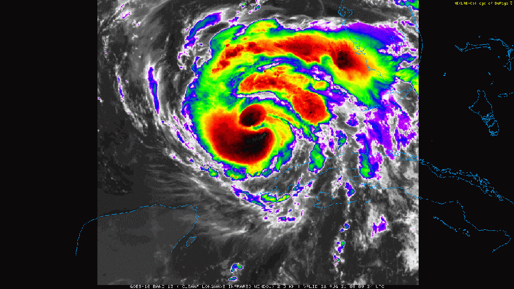
Two “vortical hot towers” (incredibly intense thunderstorms) are pinwheeling around the center and building an eyewall. Cirrus expanding in all directions indicates a lack of wind shear and ocean temperatures under the storm are extremely warm. In other words, the system should be rapidly intensifying. Is it?

Hurricane Hunter data from around the same time seems less conclusive. The pressure is still fairly high, and similar to a pass from a few hours prior. The wind field is somewhat broad and the peak eyewall winds haven’t picked up too much from prior passes. Is the storm remaining in steady state? How do we square that with satellite imagery showing twin vortical hot towers and an eyewall emerging in a very favorable environment?
The answer is that intensification, even rapid, takes time. When flying through tropical systems, Hurricane Hunter planes measure wind and pressure, both at the level they’re flying (5-10,000 feet usually for a strong storm, 1,500 usually for a weaker storm) and closer to the ground. So when you’re looking at recon data, you’re getting invaluable insight into a storm’s wind and pressure fields.
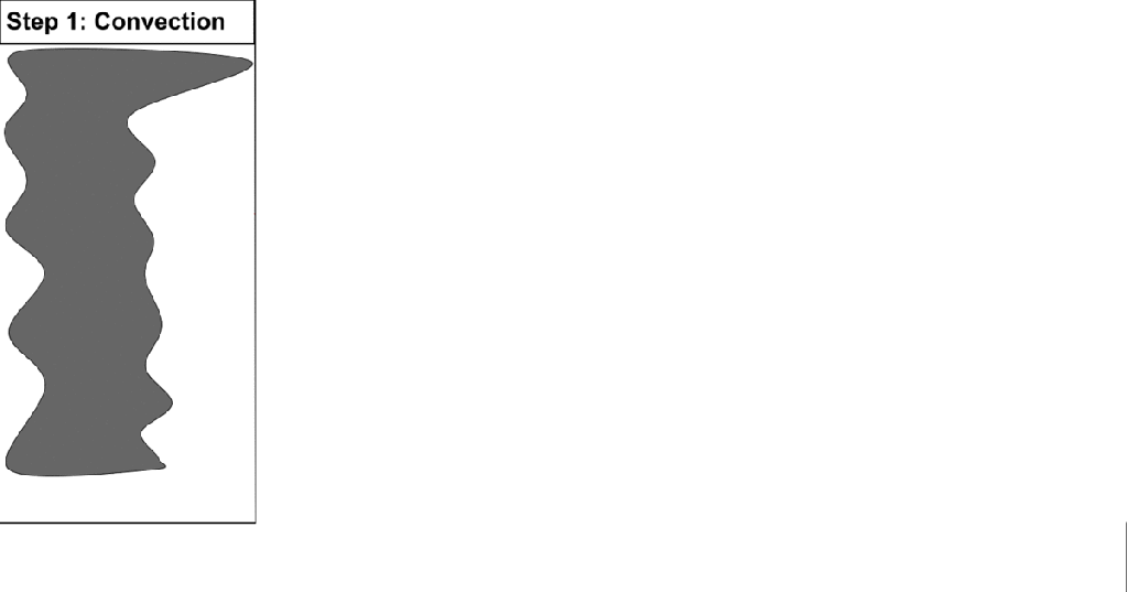
Wind and pressure fields are obviously the ones we care most about since the wind causes damage on land, and the pressure helps generate storm surge. But wind and pressure fields are lagging indicators of rapid intensification. To better understand this, let’s review how hurricanes develop. This process has roughly four steps from a thermodynamic/dynamic perspective:

The first step is thunderstorm activity. The more the better from a storm’s perspective. Once you get thunderstorms, step two can begin. Step two is the release of latent heat as tropical air soaked with water vapor is lifted into the colder middle/upper atmosphere. As the air rises and cools, water vapor condenses into water droplets, and eventually the water droplets freeze into ice crystals. As water changes phase from its high-energy gaseous state into its low-energy liquid/solid states, it “dumps” the excess energy into the surrounding atmosphere in the form of heat. When intense tropical thunderstorms persist, a lot of heat is released by this process.
As more and more latent heat is released, we start to move to step three which is the response in the pressure field. This is the first part of the process that shows up in the recon data most people look at (if you’re already watching the flight-level temperature trace you probably already know most of this stuff). The column of air heated by latent processes is less dense than its surrounding air (we know this from the ideal gas law you may remember from chemistry class) which means the pressure drops at the surface and increases near the top of the atmosphere. This is how we get low pressure at the surface and high pressure above a tropical cyclone.
Once the pressure falls at the surface, a pressure gradient develops between the storm’s center and its surrounding environment. Winds can’t pick up until this gradient develops, and even then it’s a lagged response. The pressure gradient imparts some force on a mass of air near a storm which when accelerates forward towards the storm’s center. Like any acceleration, this happens over time.
So when watching a storm develop using satellite and recon data, remember these steps. First you’ll get convection that releases latent heat, then the pressure field will respond to changes in the density of the air near the storm’s center, and then the process of accelerating air towards the center in the form of wind can begin.
How fast does a storm move from one step to the next? That all depends on its environment and its structure. This process often evolves over a week or more when a tropical wave first emerges over the ocean, especially if the environment isn’t ideal. But a pre-existing tropical cyclone like Ida moving over a near-perfect environment in the Gulf of Mexico can run through the steps in as little as a few hours.
Hopefully you learned a little more about tropical cyclones, how they work, and how to watch them more studiously, from this post. If you have any questions, drop a comment or send me a message on twitter @JackSillin.
-Jack
