Hello everyone!
The big story in the tropics this morning is still Hurricane Sally which is crawling ever so slowly towards the Gulf Coast.

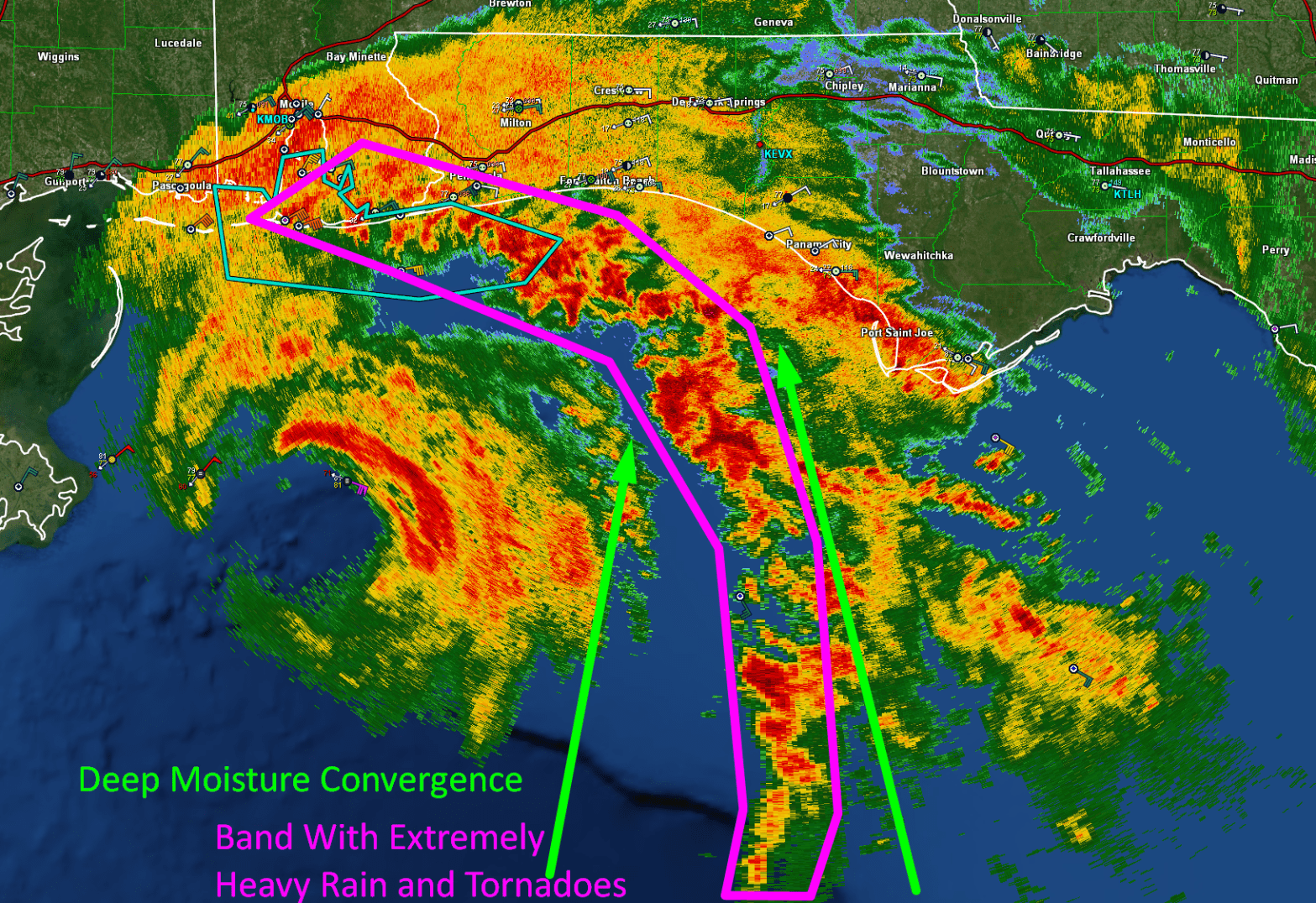
The storm has been struggling to tighten up its inner core in the face of mid-level dry air and some southwesterly wind shear. Note the lack of cloud cover southwest of the storm’s center compared to the wide expanse of clouds to the east of the center. While the shear is good news for folks in the path of Sally’s inner core, it is bad news for the Florida Panhandle which is seeing torrential rains this morning despite being relatively far from Sally’s center.

Here’s a look at early morning (6:15 CDT) radar imagery of Sally showing a ragged eyewall wrapping about three quarters of the way around the center. The eyewall is open to the southwest which is what we’d expect given the southwesterly wind shear and dry air located west of the system. Heavy rain and strong winds are now moving into southern Alabama and far southeastern Mississippi and the window of time to prepare safely for the storm has closed accordingly.

Farther east, an intense feeder band has set up from Mobile Alabama to Pensacola Florida and southeast into the Gulf of Mexico. This band will likely linger in this area for the rest of the day today into tonight, and will produce extreme rainfall totals of 1-2 feet along with embedded tornadoes.

Most model guidance is now in agreement that Sally’s center moves onshore late tonight near Mobile Bay in Alabama as a Category One or Two storm. This would put the system’s strongest winds and highest surge right over the city of Mobile. It’s important to note that the worst of the surge in Mobile Bay will hit after the eye has passed which is when winds shift from cross-shore to onshore.

After moving onshore, Sally will continue northeast tomorrow and Thursday, bringing heavy rain along with it. Folks in N GA and parts of NC/SC should be ready for flooding even though Sally will be rapidly moving towards dissipation at that point.
I’ll be covering this storm in much more detail on twitter today.
-Jack
