
Hello everyone!
After re-emerging into the Caribbean Thursday night and re-organizing into a coherent system yesterday, Eta is now re-strengthening south of Cuba.
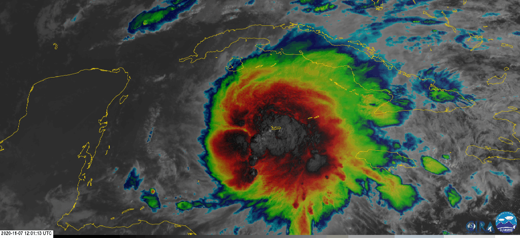
The storm has assembled some very impressive convection this morning which has pulled the center northeast of forecast expectations. This relocation will have some impacts for the storm’s track but it’s probably more important for Eta’s intensity. By moving the center northeast, the storm has put a bit more distance between itself and an upper-level low over the Gulf of Mexico. That low will be a source of dry air and wind shear in the days to come, both of which are detrimental to a storm’s organization and intensification.

Hurricane Hunters have been exploring the storm this morning and found a small region of strong winds right near the storm’s new center NW of Grand Cayman Island. Winds at the surface are estimated to be around 50 mph as I write this at 11:15 AM EST.
What’s next for Eta? I suspect our current period of intensification will continue until the storm makes landfall in Cuba tonight. Could it briefly reach hurricane strength? It’s definitely within the realm of possibility. Interaction with Cuba should weaken the core a bit. Most likely though, it’ll stay a moderate/strong tropical storm.

By tomorrow morning, the storm will be getting closer to the upper-level low over Florida. This means that shear and dry air will start ramping up a bit. After running over Cuba, Eta’s core will likely be disrupted which will make it easier for the shear to induce further weakening. That said, a strong outflow channel will be located northeast of the storm and waters between FL and Cuba are still quite warm so we’ll probably see the storm remain more or less at the same intensity (60mph TS to 80 mph hurricane) as it pivots north and northwest around the eastern side of the upper-level low/trough.
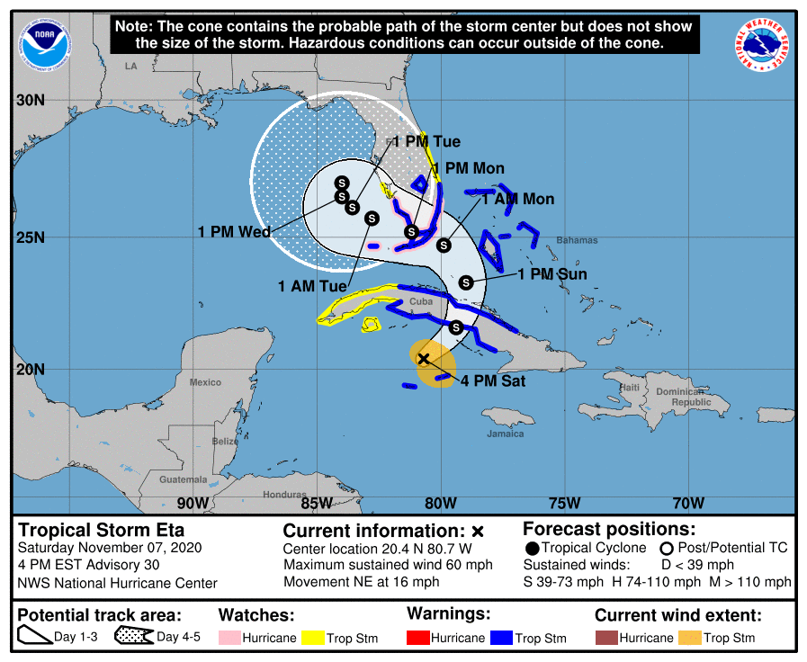
Because Eta could very well be a hurricane as it moves near or over southern Florida on Monday, hurricane watches are now up for the Keys and parts of the southern peninsula even though the official NHC forecast shows a maximum intensity near 70mph.
Regardless of Eta’s max winds, rain will be the biggest threat to southern Florida.

The storm’s slow forward motion and large pocket of moisture (despite wrapping some dry air in near the core) mean that most of southern Florida will see at least 5″ of rain over the next few days. Some spots near Miami are expected to see over 10″ of rain! Be prepared for freshwater flooding issues starting tonight and continuing through Thursday.
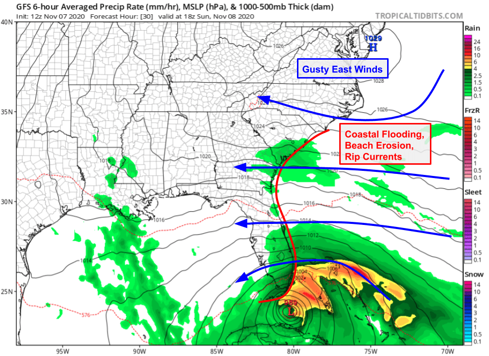
Another issue will be storm surge flooding as gusty east winds push waves and water onshore not just in southern Florida but all the way up the coast to South Carolina. Watch for beach erosion and minor/moderate coastal flooding in these areas as well as the threat of rip currents.
What happens after the storm passes south Florida?

The upper-level low mentioned above will keep pulling Eta west until it’s in the Gulf of Mexico, at which point it will probably slow down considerably. Just how far into the Gulf it can move is an open question, but the storm is likely to still retain its large impact footprint so rain and breezy conditions will continue in Florida.
Because the upper-level low and the storm will eventually be co-located, Eta will have plenty of dry air to deal with. This probably means the storm will slowly weaken. However, we’ll have to watch for another round of potential intensification if the storm can end up creating a small pocket of moisture-rich air once the shear settles down mid/late week. Either way, Eta will eventually move northeast once another trough enters the central US so folks in central/northern FL are likely to at least see some breezy rain, and potentially some more significant impacts, before we can finally say goodbye to Eta.
-Jack
