Hello everyone!
In yesterday’s update, I outlined how Zeta was expected to modestly strengthen as it moved through the Gulf of Mexico supported by rich moisture and somewhat warm water before getting slowed down by cooler ocean temperatures and increasing shear as it neared landfall. Unfortunately, the storm has organized and intensified significantly overnight and it appears as though any weakening that occurs right before landfall will be minor and inconsequential.

Satellite imagery shows a marked increase in convective intensity and organization overnight. What were once scattered storms are now powerful “hot towers” becoming increasingly symmetric around the center. The once-ragged eye is increasingly well-defined as the updrafts surrounding the center are balanced out by strong descent in the center itself. Additionally, we can see expansive outflow aloft unimpeded (so far) by the trough to the west of the storm. All of these signals point towards a healthy and strengthening hurricane.

Peering underneath the upper-level cirrus shield using microwave satellite imagery, we can see Zeta’s well-defined eye and eyewall flanked by a few robust bands. This means that Zeta’s structure is conducive to continued intensification today. It has plenty of room to continue adding convection so long as ocean temperatures permit.
Speaking of ocean temperatures, I have thought for a few days now that 25N is roughly the northern extent of really supportive warm water. The storm is just now crossing that threshold so I’ll be watching to see if convective activity begins to struggle from here on out.
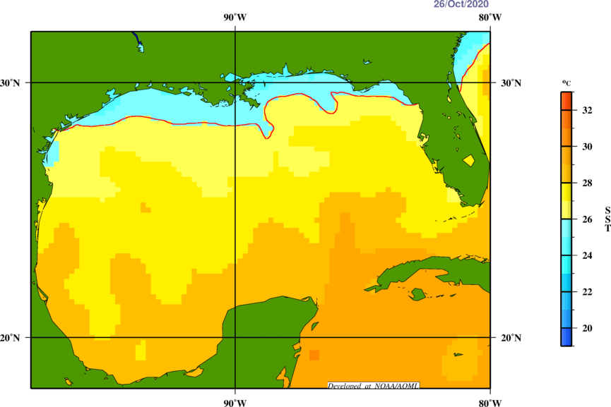
However, the water doesn’t get cold (<26C) until the last 50 miles or so before Louisiana. So it’s possible that favorable jet stream dynamics (upper-level divergence) could help Zeta continue strengthening so long as ocean temperatures aren’t unsupportive of convection. This is the scenario consistent with NHC forecasts and its the scenario folks in the path of the storm should be ready for. At this point, with the storm structure appearing as robust as it is and the storm’s forward motion being so fast, I don’t think we’ll be able to sneak much weakening in during the hours just before landfall.
Zeta will move onshore in southeastern Louisiana this evening around 5-6 PM CDT. The storm will then continue quickly inland towards southern MS/western AL.
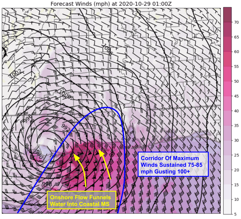
High resolution forecast model guidance provides a good look at how Zeta’s wind field will look as it moves ashore even though the numbers on this map will be an underestimation of actual winds. Note that the strongest winds will be focused east of the storm center’s track. This means that places along the Mississippi coastline 30-50 miles east of the center will see significantly stronger winds than parts of Louisiana 10-15 miles west of the center.
Another key item to note is the wind direction. Winds will be out of the southeast across the Gulf of Mexico immediately south of Mississippi. This will funnel water inland and produce significant storm surge. The shape and topography of the coastline in this area is favorable for enhancing storm surge and folks along the MS coast should be prepared for water 6-10 feet above normally dry ground.
Because Zeta is moving so fast, its swath of damaging winds will extend farther inland than most hurricanes.
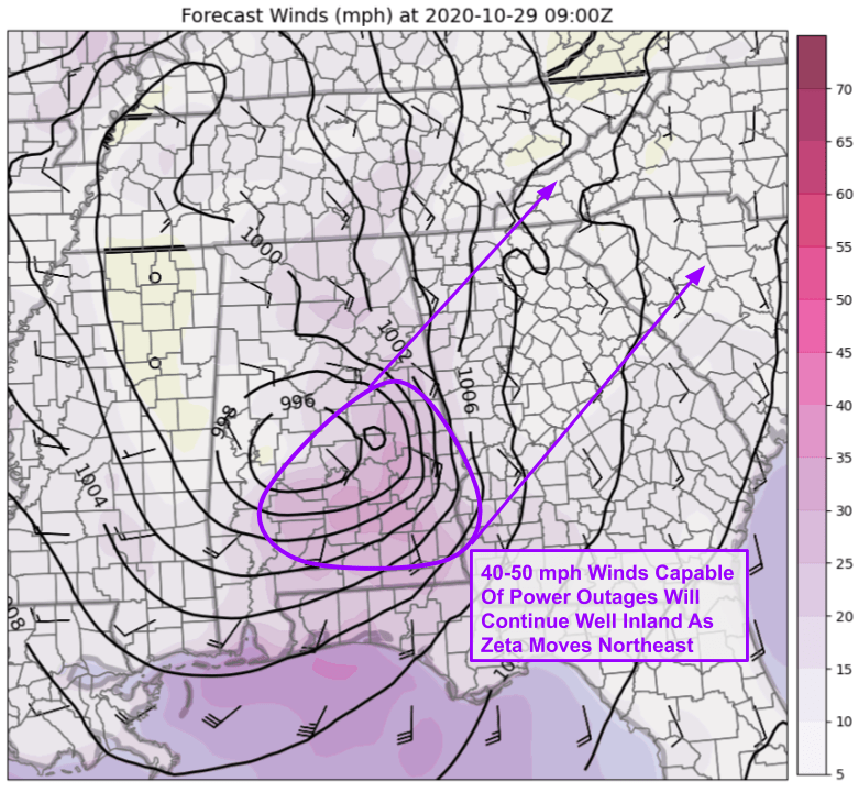
Even as the storm races through central Alabama and begins to lose its tropical characteristics early tomorrow morning, it will still be producing a region of 40-50 mph winds capable of producing damage to trees and power lines. These winds will move into northern Georgia later tomorrow morning. Folks in these areas should be ready for power outages even after Zeta weakens below hurricane strength.
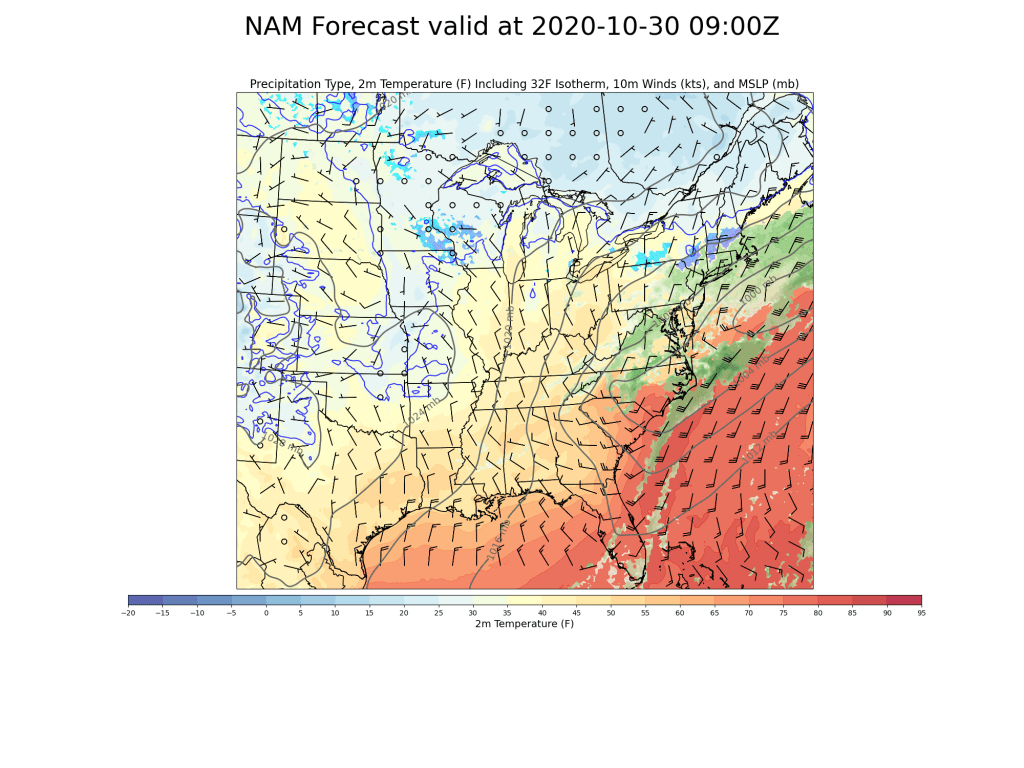
Zeta’s remnants are still expected to bring snow to interior parts of the Northeast on Friday though the trend in recent model guidance is towards a weaker and less-amplified storm bringing lighter snow to a smaller area. Oh well.
-Jack
