Hello everyone!
It’s a very busy evening in the tropics as we watch four active tropical cyclones and two disturbances that might develop in the next five days.

Each of our systems is visible on this loop of the tropical Atlantic. From west to east, we have a disturbance in the Gulf (30% chance of development), Sally (near S FL), Paulette (SE of Bermuda), Rene (SE of Paulette), TD 20 (embedded within the Inter-tropical Convergence Zone about half way between Barbados and Africa), and Invest 97L (southwest of the Cabo Verde Islands). If you look at the far eastern edge of the loop, you’ll see the first hints of our next wave set to emerge off Africa in a couple days. Unfortunately, we’ll have to keep an eye on that one too.
This update will focus mostly on Sally because it poses the most serious threat to US interests. If you’re in Bermuda and curious about my analysis of Paulette with a focus on Bermuda impacts, please check out my update on Mark Sudduth’s page earlier this afternoon.

Sally has changed little in organization today as it meandered near southern Florida. The system’s low-level center is located a bit west of Naples Florida. Note that this is a bit northwest of the storm’s deep convective activity which is located near the Florida Keys. This indicates that the system’s low- and mid-level centers are still misaligned with the former being northwest of the latter.
For most of last night, that was due to northwesterly shear imparted on the system by an upper-level low to its northwest. This evening, that low is weakening and moving away from the system so I don’t anticipate we’ll see shear continue to be an issue for Sally as we move into tonight.

That said, area-averaged soundings suggest that low-level southeasterly flow will be a bit stronger near the surface than farther aloft. This actually is a bit of a northwesterly shear signal even though there aren’t really any northwesterly winds (excluding the 5kts at 150 mb) in the atmosphere. So while the low-level center will continue to “run ahead” of most of the convection, without a strong force pushing storms to the east of the center, I’d expect to see thunderstorm activity develop and persist near the center starting later tonight or tomorrow morning.
Why wait that long? The primary factor holding back convection on the north/northwest side of Sally isn’t any upper-level wind issue or mid-level moisture issue, it’s actually a low-level problem.

I made this graphic earlier today so the radar data isn’t “fresh” but it highlights the process well. Low-level air parcels (think right near the surface) flowing into the northwestern side of Sally have spent considerable time over the Florida Peninsula instead of over the warm waters of the Gulf of Mexico. As a result, they’re a bit drier than they need to be to support convection. Parcels flowing into the southern side of the system have spent considerable time over the Gulf of Mexico picking up moisture and heat from the warm water beneath them. As a result, these parcels are jam packed with energy to support convection in a way that those parcels originating over Florida are not.
As Sally continues moving west-northwest into the Gulf of Mexico, I suspect we’ll see convection start to develop a bit more on the northern side especially once the system passes Tampa Bay’s latitude. At that point. there will be much more open water to the storm’s northeast for parcels flowing into the northern side of the system to pass over and acquire heat+moisture.

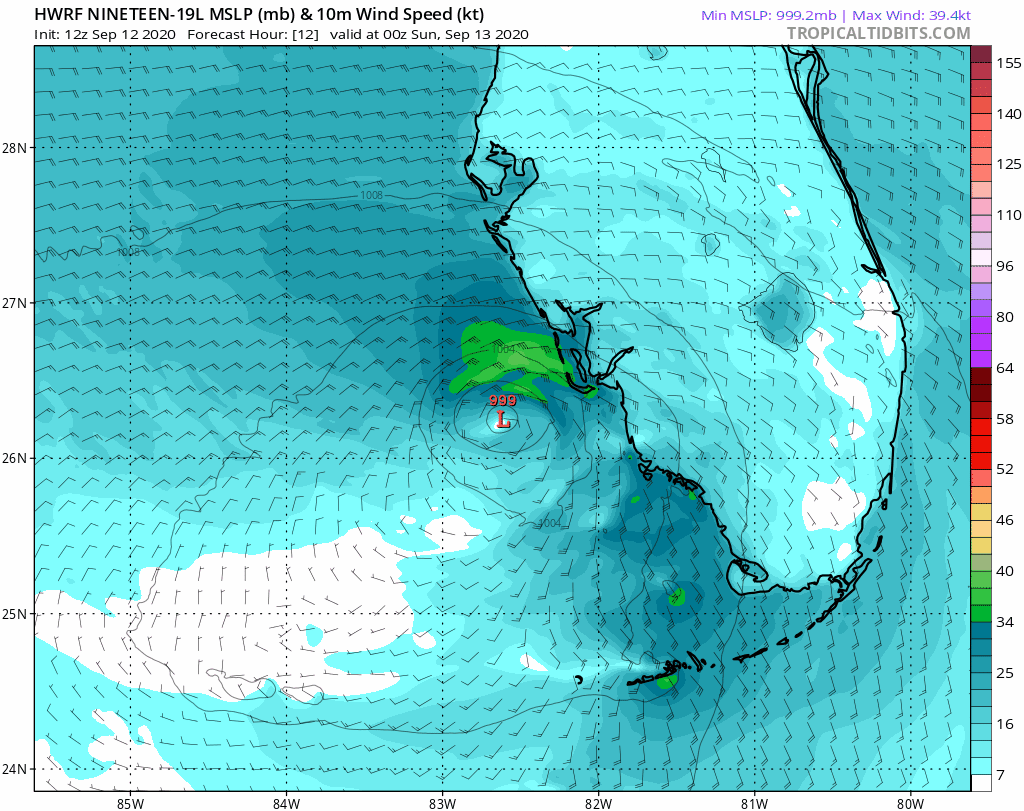
The HWRF model, which is a high-resolution model specifically designed to predict hurricanes, shows this idea well. It depicts Sally struggling to organize until it passes north of 28N which is about where Tampa is. After that, it has a bit more “room to breathe” on the northern side and as a result is able to strengthen quite a bit more.

A look at the upper-level environment shows a setup extremely conducive for intensification come tomorrow evening. The storm will be located under an upper-level anticyclone well-positioned to vent the system in the upper levels of the atmosphere. That venting will be assisted by an upper-level trough northeast of the storm and an upper-level low southwest of the storm (the same one that has been causing shear today). This upper-level pattern is a very strong indicator of potential for rapid intensification if the storm’s structure is organized enough to take advantage.
As the storm approaches the Louisiana coastline, it will start to encounter another obstacle: mid-level dry air and increasing westerly shear ahead of an upper-level trough.

Storm-centered cross sections on the HWRF model show the potential for some dry air intrusion as the storm nears the SE Louisiana coastline. It’s really hard to tell ahead of time how exactly the storm will interact with this type of dry air/shear. If its inner core is intense enough, it will barely notice this level of disruption (a la Laura). If the inner core is still struggling to get together, it could weaken quite a bit (Marco was an extreme example of this, though I wouldn’t expect that much weakening from Sally). I include this in here not to downplay the threat from Sally but to offer a little bit of hope that the door is still open to a lower-impact scenario. Prepare for the worst and hope for the best.
So what should residents of the northern Gulf Coast expect from Sally?

This map shows various key information from the NHC’s 5 PM update including the cone of uncertainty, projected wind radii, projected maximum wind speeds, rainfall, and watches/warnings. Note that dangerous impacts in the form of heavy rain extend well east of the center. So while landfall is expected in Louisiana, heavy rain (6-12+”) capable of major flooding issues will fall as far east as the Florida Panhandle. Storm surge of 1-3 feet is projected as far east as the Big Bend area of Florida. So while the landfall point and cone of uncertainty thereof get lots of attention, remember that even if you’re outside the cone and perhaps outside the worst of the winds, this may very well still be a dangerous storm for you.
Also note that Hurricane Watches are now posted for parts of southeastern Louisiana including New Orleans as well as southern Mississippi and southern Alabama. The time to start preparing for hurricane conditions in these areas is now.

As Sally approaches the northern Gulf Coast, it will slow down in response to a building ridge over the Plains. It may only be moving 3-5 mph, about as fast as most people can walk/run, when it makes landfall. This means that the system’s winds will have additional time to pile storm surge into the coast and heavy rain will linger over the same areas for quite a while. The net result, particularly if the storm does end up moving quite slowly, is an amplification of water-related threats.
The system will move inland sometime during the middle of next week. Heavy rains will continue for a while inland, but because the storm is moving so slowly, intense winds are not expected to continue inland like they did with Laura.
If you’re currently under a Hurricane Watch, begin preparations for Sally now. Always heed the advice of local officials and consult with official NHC/NWS forecast information when making any decisions that involve the protection of life and/or property.
-Jack

One thought on “TD19 Becomes TS Sally, Expected To Make Landfall As A Hurricane In SE Louisiana Tuesday”